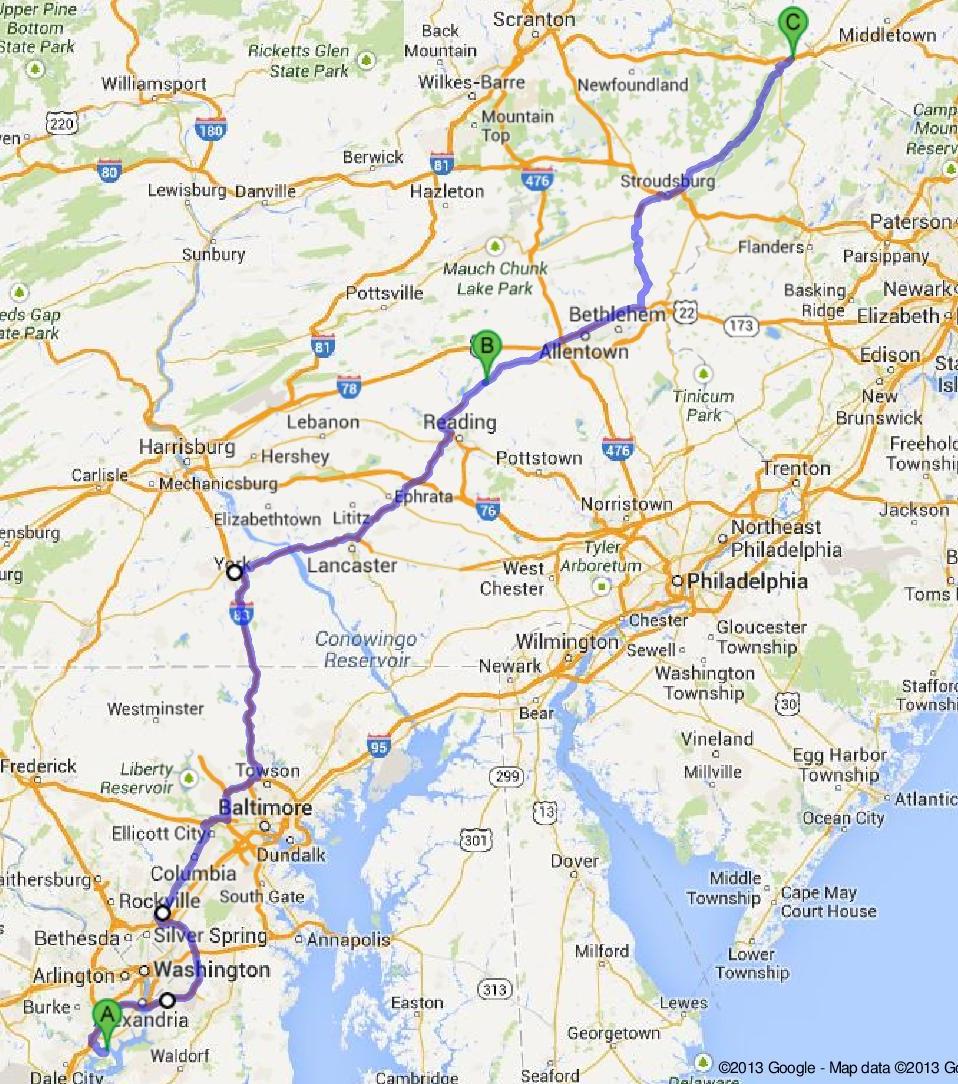
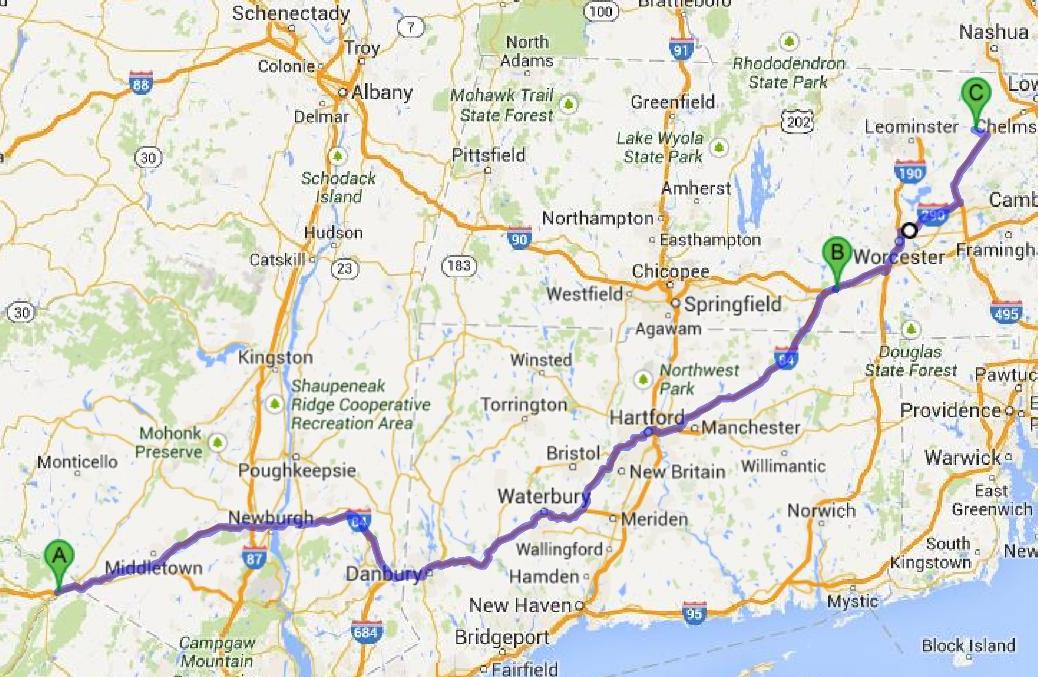
2 day, 534 miles via I-95, I-495, US 29, I-70, I-695 (near Baltimore), I-83, US 30, US 222, I-78, US 22, PA 33, US 209, I-84, I-90, I-290 (near Worcester), I-495 (near Boston) amd MA 2A.
This was a grueling weekend, primarily due to the fatigue from the previous weeks, the complicated route to our overnight stop and the heavy traffic on I-84 through Connecticut. This route, which took us west of Baltimore, Philadelphia and New York, is not the shortest way to get to MA, but it has the very significant advantage of avoiding all of that urban traffic.
Day 1: Lorton, VA, to Milford, NY
This was arguably the most complicated route we have ever taken in a single day. We got lost twice, sort of. My original intent was to take I-495 north, west of DC, but somehow got it into my head that I-95 went west of DC, too. So when I got to that massive interchange in Springfield, VA, where all sorts of major roads meet, I followed the I-95 north signs. I was happily cruising along a few miles later and saw the exit for Mt Vernon. That woke my brain up and made me realize that I was going to pass DC to the east, at a cost of some 10 extra miles. Had I known I was going to go that way, I would have continued up I-95 to just south of Baltimore. But I had planned on going north on US 29, west of I-95, and didn’t want to make on-the-fly changes to my plans, so I continued on to US 29 which turns out to be rather commercial the first few miles. I certainly would have saved time by going I-95. Next time.
The second “lost moment” was in York, PA. The Google map told us to take Exit 18 off of I-83, the GPS told us to take Exit 19 – neither of which were signed to connect to US 30. So we continued on 2 more exits to the US 30 connection. When I looked back at the route, I saw the US 30 runs parallel to I-83 for several miles and I could have cut off 4 or 5 miles by following either the map or the GPS. But I really need to take a close look at those shortcuts before I take them. Shortcuts usually spell trouble for RVs.
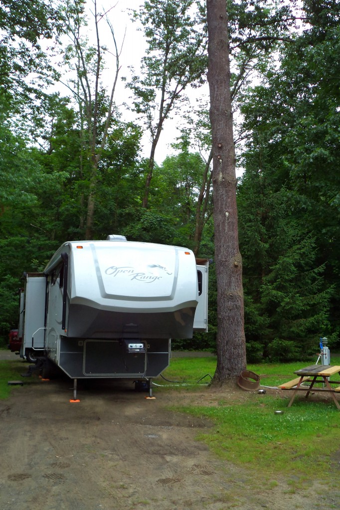
We stayed the night at Kittatinny River Beach Campground in Milford, NY. This is a canoeing/kayaking center first and a campground second. I got the impression that many of the campers (which included a lot of tents) were there for the river experience. But the nice couple next to us were there for antique car shows. There was one show that weekend a few miles west of Milford, and one right in Milford starting on Monday.
The campground was water and electric only, which is fine for a night. It actually makes setting up/tearing down much faster.
Day 2: Milford, NY, to Littleton, MA
These 231 miles were easy to navigate. Almost the entire route was on familiar roads. Jett could just sit back and enjoy the ride, except that she didn’t. The traffic was heavy – it always is on I-84 – and most of I-84 was very bumpy, as usual. We tried to stop for gas at the Charlton Service Plaza on the Massachusetts Turnpike, but couldn’t find the diesel. It turns out that diesel is offered on the auto side only on the last pump or two. Message to the Massachusetts Turnpike: some signs indicating where the diesel is located would be useful.
But we actually didn’t need the refueling stop. We made it to our campsite at the Boston Minuetman Campground in Littleton without incident and without the low fuel light appearing.
I will report on the campground after we settle in.
Thus ends the QTE.
Hey, Massachusetts, we’re here! And pissa glad that we made it safely.

