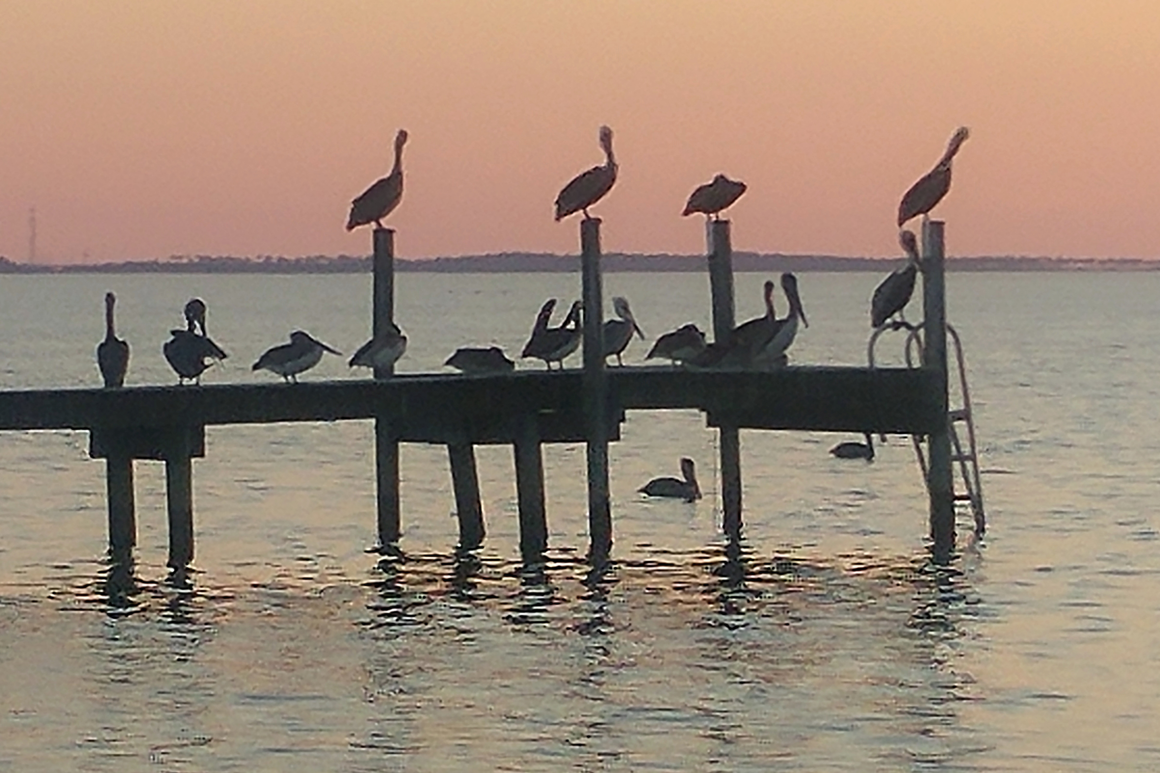
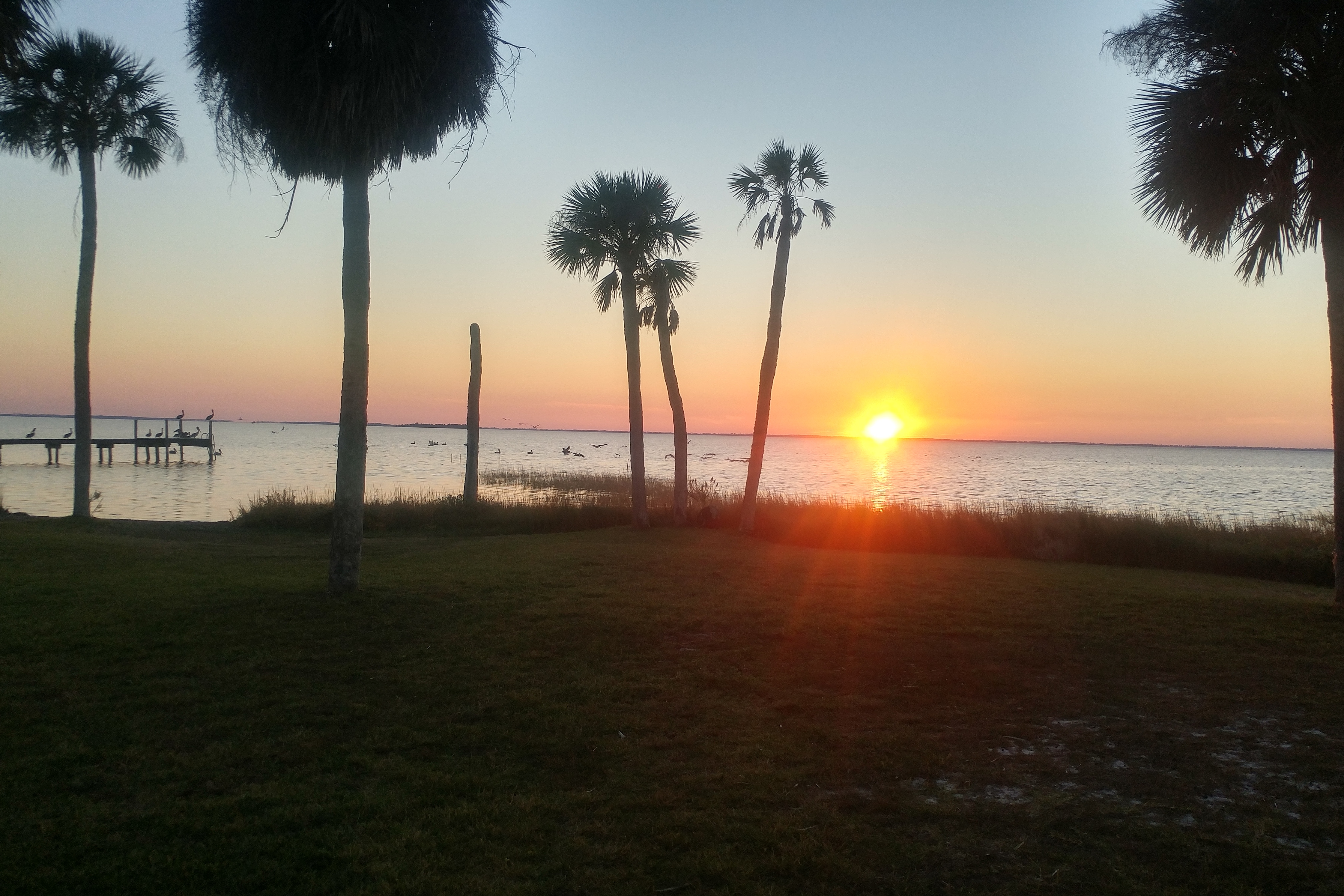
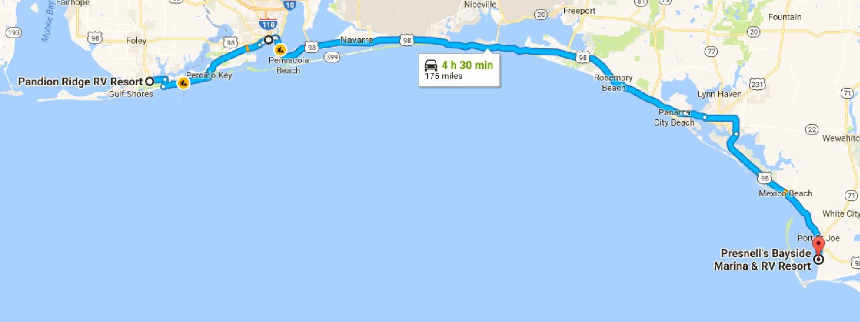
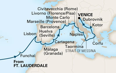
STE2 Hop 4: Junction City KS to Bartlesville OK

STE2 Hop 4

STE2 Hop 4

209 miles via US 77, US 400, KS 99, US 166, US 75 and US 60 with a refueling stop in El Dorado KS. Cumulative tow miles: 918. Truck miles: 209. Cumulative truck miles: 940.

The truck miles equaled the tow miles in the case because we did something we almost never do: we stayed hitched up overnight. That meant that we needed to plan a refueling stop for Hop 4. There weren’t a lot of options – we didn’t pass a single gas station in the nearly 90 miles to El Dorado. And we cut it close – the low fuel light popped on as we turned into the service station. But we made it, no problem. We even took a lunch break.

The route was, as usual in Kansas, boring. The only thing that made it interesting is that the corn and wheat harvests were in high gear and nearly every field had harvesting activity. Which also meant that there were a lot of trucks on the road hauling the harvest. But no major slowdowns.

Our one-night stop in Kansas was at the Owl’s Nest Campground. Our original plan was to spend 2 nights here, but we cut it to one in order to make it to Bartlesville OK on Friday – so we could get to the Osage Nation Museum on Saturday. It turns out that we didn’t like the campground much and were very glad it was just one night. The campsites were mostly small and the roads were narrow. Plus there was no cable TV and absolutely no over-the-air service. So we played cards, watched DVDs and left without looking back.

While we didn’t like our overnight stay very much, we had to appreciate it for what it was: the culmination of our 5-year goal to visit all 48 states.

Refueling stop in El Dorado

Refueling stop in El Dorado

#48 - Kansas

#48 – Kansas

Hitched up at our site

Hitched up at our site

Categories: KS, OK, Places, Routes, RV Parks, STE | Leave a comment

STE2 Hop 3: Kearney NE to Junction City KS

STE2 Hop 3

STE2 Hop 3

242 miles via I-80, NE 10, KS 8, US 36, US 81 and I-70. Cumulative tow miles: 709. Truck miles: 258. Cumulative truck miles: 731.

Sunset at the Kearney RV Park

Sunset at the Kearney RV Park

This was another boring trip in terms of the scenery, but this time we had some navigation issues to keep us busy. I originally planned this to be a 230-mile trip the used only about 6 miles of I-70 at the end. But Jett convinced me to add a refueling stop and, knowing that range was no longer an issue, opted for a slightly longer but faster route down US 81.

We saw a lot of corn, much of it being harvested. Consequently we had some trucks on the road carrying corn and wheat. But not many. Traffic was not a problem.

The truck ran flawlessly once again. It has now been over 1,000 miles since it was repaired. I am starting to think that the repair was good.

For the two nights in Kearney we stayed at the Kearney RV Park & Campground. This was a nice short-term place. Concrete pads on large pull-through sites. No cable TV but we pulled in about 10 channels over the air. Not that it mattered, but the park had a lake with a beach. And it was near shopping. We dined at Culvers the first night and at Whisky Creek Wood Fire Grill the second night. Whisky Creek was a mixed bag. The salad and bread were simply excellent. The prime rib… not so much. Very strange prime rib. Almost like ribeye – very fatty. And not very thick. Good flavor but still disappointing.

Categories: KS, NE, Places, Routes, RV Parks, STE | Leave a comment

STE2 Hop 2: Chappell NE to Kearney NE

STE2 Hop 2

STE2 Hop 2

190 miles, almost exclusively on I-80. Cumulative tow miles: 467. Truck miles: 204. Cumulative truck miles: 473.

Funky trailer and nearby factory

Funky trailer and nearby factory

This route was Boring, with a capital B. Straight, flat, a few trees among the fields, but everything brown. Dull, uninteresting.

All of which didn’t help Jett’s headache. We were supposed to stay in Chappell for 2 nights – and paid for two – but two things combined to cut it short: (1) I learned that the Osage Nation Museum, which I had scheduled for a visit next Monday, was closed on Mondays and (2) the train traffic in Chappell, with loud horns blaring all night long, kept Jett from getting more than about 2 hours sleep. Which explained her headache.

Normally I would not want to travel when she is feeling so lousy, but when the reason for her illness is the campground… what’s a guy to do? The Osage Nation Museum problem pushed the decision over the edge. I decided that I needed to get to Bartlesville OK two days early. The only way to do that was to cut a day out of Chappell and a day out of Junction City KS (our next stop after Kearney). So I called, made the necessary changes to reservations and, once Jett was feeling well enough to travel, headed to Kearney.

The fact that we paid for 2 nights actually helped as we could leave a couple of hours later than normal. We departed Chappell at 1:30 and got into Kearney at 5:30 pm, losing an hour along the way due to the time zone change. But it all turned out to be worth it when Jett got a good night’s sleep last night.

Our train-filled night in Chappell was at the Creekside RV Park & Campground. If you follow the link you will see that it actually gets pretty good ratings. Not from us. Yes, the elderly hosts were very nice, and the site was large and level, but the train noise negatives overwhelmed any positives. It is a very basic park. I also made the mistake of choosing a 50-amp site with no water over a 30-amp site with water. Not having water meant that we had to operate off of our internal fresh water tank, which is fine, except that the pump noise is very irritating. That didn’t help Jett’s headache, either.

In addition to being adjacent to the train tracks, the campground was also near a large grain elevator or similar structure that had a lot of truck traffic. There were also some interesting long-term resident rigs in the park, including a trailer with a bolt-on deck. Unique.

On a positive note, I liked Chappell. It is an interesting small town that seems to be brimming with civic pride. I shopped at a very funky old-fashioned food market that had a nice meat section and decent prices. I got some really good photos of the beautiful sunset and we got to add our 47th state. But the negatives outweigh the positives. We won’t return.

Sunset in Chappell

Sunset in Chappell

Our site at Creekside

Our site at Creekside

#47 - Nebraska

#47 – Nebraska

Categories: NE, Places, Routes, RV Parks, STE | Leave a comment

STE2 Hop 1: Rawlins WY to Chappell NE

STE2 Hop 1

STE2 Hop 1

Our site in the gravel lot

Our site in the gravel lot

269 miles almost entirely via I-80, with a refueling stop. Cumulative tow miles: 269. Truck miles: 269. Cumulative truck miles: 269.

This was a very easy navigation hop, but it was a true test of the truck repairs. We passed over the Rockies at 8500 feet. The engine got pretty warm, but didn’t overheat. Once over the pass it was a long, slow downhill trip to Chappell NE, elevation 3700 feet. Not only did we get out of the heights, we got a bit warmer, too. It was in the low 70s when we arrived in Chappell. Relief!

We refueled just east of Cheyenne and had a Burger King lunch. A whopper for me. Better than the carrots that I usually get for lunch while traveling.

Our overnight stay in Rawlins was at the Western Hills Campground and RV Park. This was a gravel parking lot where the only amenities were a dog park and cable TV. But those are the only amenities we care about, so it was fine for an overnight stop. We had dinner at the Golden 8 Chinese Restaurant. It had a very nice buffet for a reasonable price. Not spectacular, but a pretty good meal. Then we took a brief tour of Rawlins before refueling for the next hop. It is an interesting little western town.

Categories: NE, Places, Routes, RV Parks, STE, WY | Leave a comment

STE2 preview

STE2 Plan

STE2 Plan

Due to the truck problems and the decision to avoid the 11,000 foot pass on I-70, the starting point for the second segment of the STE (STE2) has changed significantly. So I thought I had better update the STE2 plan.

It starts in Rawlins WY and terminates in Brownsville TX. It will consist of 9 hops over 19 days for a total towing distance of about 1900 miles. The highlights will be completing our 48-state map and checking out the RV parks in southern Texas to see if we might want to spend a future winter down there. We will also visit the Osage Nation Museum and will see Jett’s sister and nephew in Austin.

And, perhaps most importantly, it will be warmer. The chill is really getting to us.

Categories: Preparation/Planning, STE | Leave a comment

STE1 wrapup

Our one-night stay in Rawlins WY concluded the first segment of the STE. The segment by the numbers:

  • 8 hops
  • 17 nights
  • 1605 tow miles
  • 2033 truck miles
  • $719.56 in campground fees ($42.33 per night)

This was not the segment that we planned.  The planned versus the actual routes:

STE1 Plan

STE1 Plan

STE1 Actual

STE1 Actual

Highlights:

  • Visiting Tillamook again and catching up with my sister and her husband.
  • Seeing Canyonlands and Arches National Parks.
  • Touring the Mormon Tabernacle and other LDS buildings.
  • Catching some incredible sunsets in Oregon and Idaho.
  • Getting the truck fixed quickly and relatively painlessly.

Lowlights:

  • Having the truck fail in Salina UT. Fortunately we were able to get to a campground and were safe and warm while we waited for repairs.
  • Missing out on Bryce Canyon and Zion National Parks due to the truck problem.  We also had to skip Monument Valley.  All huge disappointments.
  • The cold weather.  We had to endure a number of sub-freezing nights, including one, in Silt CO, that dropped to 25 degrees.  I had to wrestle with a frozen hose to pack up there.  We also had to adjust our schedule to avoid snow in Wyoming.  In general, this entire segment has been much colder than I expected for early October.

The next segment, STE2, will take us through Nebraska and Kansas, completing our 48-state map.  It will also get us down to Oklahoma and Texas and, hopefully, into warmer weather.

Categories: Routes, STE | Leave a comment

STE1 Hop 8: Silt CO to Rawlins WY

STE1 Hop 8

STE1 Hop 8

216 miles via I-70, CO 13, WY 789 and I-80. Cumulative tow miles: 1605. Truck miles: . Cumulative truck miles: 2026.

This was a “Plan B” hop. Plan A was to drive from Silt to Denver via I-70. But I scotched that plan after I took a close look at I-70. The mountain passes were extremely high (one at 11,000 feet and another in excess of 10,000 feet) and the road was very narrow and downright dangerous in places. And steep – both going up and coming down. I couldn’t be sure that the truck could handle it.

Plan B was to drive north and take I-80 across the Rockies. This hop gets us north; the next hop gets us across the Rockies via an 8500-foot pass. About the same height as the one in Yellowstone, so I know the truck can do it.

One of the downsides of Plan B is that the first half – up to Wyoming – was almost exclusively on 2-lane state highways: 13 in Colorado and 789 in Wyoming. But the route is sparsely populated and lightly traveled. It was a fairly pleasant ride in clear, if cold (mid-50s), weather. It was completed almost non-stop. Just a couple of lights in Craig CO, the only town of any size on the route.

Our home for the two nights in Colorado was the Silt/Colorado River KOA. This was a pretty basic campground, but the pullthrough sites were large and flat and it was situated on the banks of the Colorado River. The river is not very big at this point, but it flows rapidly – about 5 mph. And since the trees were pretty much in their prime autumn colors, I was able to get a couple of nice river photos. The trees do not have the vivid reds and oranges that New Englanders are used to, but the yellows are very bright.

Because this was our first (and maybe last) stay in Colorado, we were able to add the 46th state to our map.

Colorado River colors at dusk

Colorado River colors at dusk

Silt KOA

Silt KOA

#46 - Colorado

#46 – Colorado

Categories: CO, Places, Routes, RV Parks, STE, WY | Leave a comment

STE1 Hop 7: Moab UT to Silt CO

STE1 Hop 7

STE1 Hop 7

179 miles via UT 191 and I-70. Cumulative tow miles: 1389. Truck miles: 379. Cumulative truck miles: 1759.

The best thing about the trip to Moab was that the truck handled the load just fine. Every hop now increases my confidence that the truck repairs actually fixed the problem. Still, we have decided to avoid the 11,000-foot pass on I-70; the last hop in STE1 will be north to Rawlins WY. We can go straight to Nebraska from there over a less demanding 8,500-foot pass.

The weather on this hop was clear but very hazy. I think it was just due to atmospheric conditions, but I can’t rule out the possibility that part of it was smoke from the California wildfires.

The high truck miles were due to the visits to the national parks – Canyonlands and Arches (twice). I have blogged about those trips separately.

The other feature of the stay in Moab was Moab itself. The Colorado River canyon on the edge of Moab was very beautiful. And the RV park had mule deer that weren’t intimidated by our presence. Rusty and I encountered them twice. Rusty was very interested but, surprisingly, did not bark at them.

Colorado River canyon at dusk

Colorado River canyon at dusk

Mule deer

Mule deer

We stayed 3 nights at the Moab Valley RV Resort. We booked late due to the truck problems and they could accommodate us for only 2 nights. They found a place for us for the third night, but we had to move. I think that is a first in our travels. I suppose you could even call it a “hop” – of about a tenth of a mile.

The park was nice, but a bit cramped. I got an “extra vehicle” space for the truck, to keep its butt from hanging out on the campground road. There was a $5 fee (per night) for the space, which was waived for the first 2 nights. The staff person I dealt with when paying for the third night wasn’t so generous.

The park was right on a road so it was a bit noisy. But a red cliff also loomed over it, which made it kind of exotic. I guess overall we liked it and would return.

We also liked Moab. We only took one trip into town and that was for food shopping. There were some interesting restaurants but the only establishment we visited was Denny’s. Sometimes you just need a Moons Over My Hammy.

The campground

The campground

Our site, first 2 nights

Our site, first 2 nights

Categories: Places, Routes, RV Parks, STE, UT | Leave a comment

Arches National Park

Windows Arch

Windows Arch

I visited Arches National Park twice – by myself late afternoon on Thursday and with Jett Friday around noon. The second visit was to give Jett an opportunity to see this beautiful park, but I also wanted to take a look at the “Windows” area, which I had skipped when I ran out of time on Thursday. Besides, Friday was even clearer than Thursday.

The roads in the park were being resurfaced, which made it more difficult to get around. Some areas – most notably the “Park Avenue” area – were totally closed, which was disappointing. But the park has so many features that there was still plenty to see.

The entrance to the park is flat, but it immediately transitions into a climb up the side of a cliff. In less than a mile the road rises over 500 feet, producing a panoramic view of the Moab Valley. From there it flattens out and the rest of the 18 mile ride is relatively flat and easy, with just one additional drop – maybe 200 feet – into a valley.

Many of the arches require a walk to get close. Jett wasn’t interested in any hikes and I was pressed for time on Thursday, so I only did two hikes. The first was about a half mile up to a promontory, to view the Delicate Arch. I found that view disappointing and probably not worth the effort. The second hike was about a quarter mile, into a chasm containing the Sand Dune Arch. That hike was eerie and definitely worth the effort. But I found myself wishing I could find a time when the lighting was better. But with the chasm being as deep as it is, there may never be a time when it gets direct sunlight.

Devils Garden

Devils Garden

Plains vista

Plains vista

Tower of Babel?

Tower of Babel?

Sand Dune Arch

Sand Dune Arch

Random rocks

Distant view of Delicate Arch

Courthouse Towers

Courthouse Towers

Colorful valley

Colorful valley

Moab Valley vista

Moab Valley vista

Chasm to Sand Dune Arch

Chasm to Sand Dune Arch

Near Sand Dune Arch

Near Sand Dune Arch

Climbers

Climbers

"We Three Kings"

“We Three Kings”

Phallic rock

Phallic rock

Obelisk pair

Obelisk pair

Balanced Rock

Balanced Rock

Categories: Adventures, Places, STE, UT | Leave a comment

Canyonlands National Park

Overlook of White Rim Trail

Overlook of White Rim Trail

Canyonlands National Park is one of two national parks near Moab UT, the other being Arches National Park. I visited both, but I went to Canyonlands first, yesterday morning, because the day started out cloudy and, since it was farther away – about 30 miles – I figured that it might clear up a bit by the time I got there. I was right.

Canyonlands is not one of the better-known parks. It is a bit difficult to get to. You first have to find your way to the Moab area, which is 30 miles from I-70. Then you have to drive over 20 miles up a dead-end road to even reach the gate. Before you get there signs warn you that there are no restaurants, no gas stations, no water in the park. The only service provided is toilets. Primitive toilets. This is not a hospitable park.

But it is beautiful.

I really liked this park. I think it is arguably as interesting as Grand Canyon National Park. And more varied in its vistas. It has both towering rock monoliths and gaping canyons. And it has something that the Grand Canyon does not have – challenging offroad trails. The White Rim Trail is a 100-mile trail around the rim of the lower canyons. It is flat and is probably not a challenging drive, but the length of the loop and the isolation of the area (the park warns that, should your vehicle become disabled, towing charges could exceed $2,000) would make it an intense driving experience – probably a multi-day experience.

I should note that the park is huge with several distinct “units”. I visited the most popular and most accessible unit, the “Island in the Sky” which offers a 17-mile (one-way, 34-mile roundtrip) scenic drive in the highest sections of the park. At the point it overlooks the White Rim Trail it is probably more than 1,000 feet above the trail.

Anyway, I will let the photos tell you how much I liked the park.

Monitor and Merrimac

Monitor and Merrimac

Canyon

Canyon

Far and deep

Far and deep

Shafer Canyon

Shafer Canyon

Red walls

Red walls

Axtec Butte?

Candlestick Tower?

Vista

Vista

Buck Canyon Overlook

Buck Canyon overlook

Long way down

Long way down

Some looking up too

Some looking up too

Edge of the canyon

Edge of the canyon

Categories: Adventures, Places, STE, UT | Leave a comment