STW3 Hop 4: Missoula MT to Post Falls ID

STW3 Hop 4

STW3 Hop 4

171 miles via I-90 and local roads. Cumulative tow miles: 557. Truck miles: 214. Cumulative truck miles: 711.

This was an easy trip for navigation: a couple of turns to get onto I-90, a couple of turns to get off of I-90. Otherwise, just follow I-90. However, the trip was preceded by a trip back to the tire place to get the torque on the lugnuts checked, plus two rest area stops to make sure that none had come loose. Everything was fine, but to say we were spooked by the specter of wobbling tires would be an understatement.

There was also a number of significant climbs over passes – one up to 6000 feet – and it was all done in rain. Not heavy rain, but steady rain.

Not a fun hop.

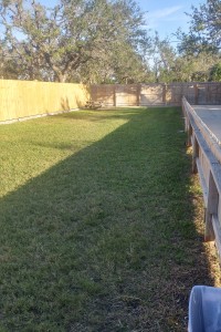
Dog park

Dog park

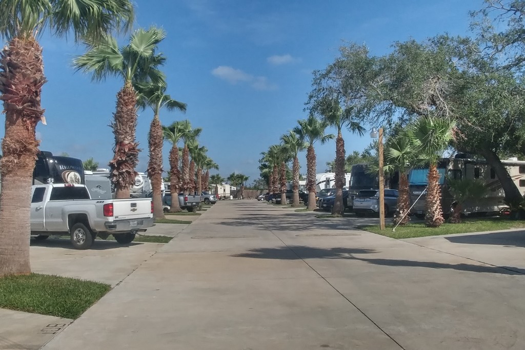
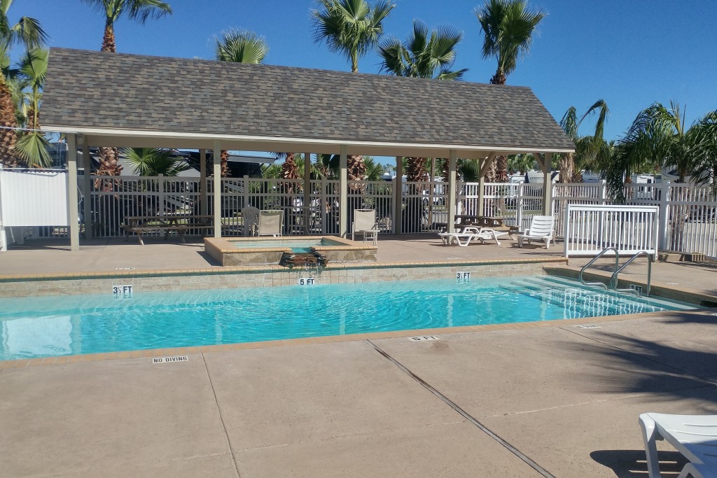
Our home in Missoula was the Missoula KOA Journey campground. The campground was very nice – nice pool/hottub, nice store, nice store, nice dog park. And big, wide sites with separate parking spaces. If we ever return to Missoula (unlikely) we will come back here.

It also had a wonderful sunset on the day we arrived. A pretty good one the next night, too.

But as our stop in Missoula was primarily a regroup and resupply stop, the main feature of the campground was location: it was within 2 miles of Costco, Walmart, Staples (a new laptop for Jett), a laundromat (clean underwear!) and tire places (2 new tires). Everything got done and Missoula benefitted from our spending.

First night sunset

First night sunset

Second night sunset

Second night sunset

Categories: ID, MT, Places, Routes, RV Parks, STW | Leave a comment

STW3 Hop 3: Ennis MT to Missoula MT

STW3 Hop 3

STW3 Hop 3

198 miles on US 287, MT 359, I-90 and US 93. Cumulative tow miles: 386. Truck miles: 208. Cumulative truck miles: 497.

This hop, except for the first 40 miles, was almost exclusively on I-90. We did make two stops: a rest area stop about 150 miles into the trip and an emergency stop a few miles later because I noticed that one of the rear truck tires – the spare put on the night before by AAA – was wobbling. I tightened the lug nuts and made it the final 20 miles to the campground where I tightened them again.

That was WAY too close to disaster. I never, ever want to see my tire wobble again.

Other than that, Mrs. Lincoln, how was the trip? Just fine, thanks. Beautiful, in fact, though still chilly, with snow-covered mountains everywhere.  There were also a couple of long uphill climbs that surprised me as Missoula is at 3200 feet elevation, a 1700 foot drop from Ennis.  In fact at one point we were at 6400 feet, a 1500 foot climb from our starting point. Up and down.  But the truck handled it just fine.

Except for almost losing a tire.

Snow-covered mountains nearby

Snow-covered mountains nearby

Our one-night stay was at the Ennis RV Village in Ennis MT (population about 900), in the middle of nowhere.  As I explained before, the sole reason for being in Ennis was that it was lower – and warmer (low of 32 versus 25) – than West Yellowstone.  It was not a good place to look for tire repair, though AAA eventually came through for us.  And there was a food store less than a mile away, so we didn’t starve.  The site was large and flat.  More than adequate for an overnight stop.
Plains and mountains

Plains and mountains

Categories: Adventures, MT, Places, Routes, RV Parks | Leave a comment

STW3 Hop 2: West Yellowstone MT to Ennis MT

75 miles via US 20, ID 87 and US 287. Cumulative tow miles: 189. Truck miles: 155. Cumulative truck miles: 289.

More than any other hop, this one felt like an emergency. It snowed 2″ last night, with the temperature dropping to 30 degrees. The forecast for tonight in West Yellowstone is for a low around 25 degrees – cold enough to freeze the water line. We felt some urgency to get to a lower elevation. By going 73 miles to Ennis MT we dropped from 6800 feet to 4900 feet. Just enough to get below the snow. Just enough to stay above freezing.

Oh, by the way, we had to cancel our plans to visit Glacier National Park because it is burning up. The rains yesterday might have made their situation less critical, but the idea of visiting a smoldering park covered with snow just didn’t appeal to us. Even if it has glaciers.
So we have had to rethink this segment of the STW. We still plan to hit Coeur d’Alene, but will get there via Ennis MT (1 night) and Missoula (2 nights). The day in Missoula will be spent replacing Jett’s laptop, which failed two days ago, and getting two new tires for the truck because the tread is wearing thin.
Just to make life more interesting, I popped the valve stem on one of the tires that I was planning on replacing in two days while setting up in Ennis, so I am now awaiting a visit from AAA to change it.

Did I mention that I put a little dent into the BigHorn a few days ago? This whole segment is becoming reminiscent of the “ding-a-day” period when we first went on the road in the fall of 2012.

Anyway, our time in West Yellowstone was spent at the Yellowstone Grizzly RV Park, a very nice park on the edge of “downtown” West Yellowstone. The town is interesting, with dozens of hotels, motels and inns, interspersed with restaurants and tourist attractions. Had the weather been better we probably would have spent a few interesting hours strolling around. But with the cold and snow, we spent our free time hunkered down in front of our electric fireplace. Survival.

Snow at Yellowstone Grizzly

Snow at Yellowstone Grizzly

STW3 Hop 2

STW3 Hop 2

Categories: ID, Places, Routes, RV Parks, STW | 1 Comment

Yellowstone National Park – part 2

Buffalo

Buffalo

On Tuesday I made a day trip into Yellowstone National Park (“part 1”) and on Wednesday we traveled east-to-west through the park with an aborted attempt to see Old Faithful. So yesterday – Thursday – I made a second day trip into Yellowstone with the primary purpose being to view Old Faithful.

It turned out to be much more than that.

I entered the park around 10:15am via the west (West Yellowstone) entrance where traffic was heavy. I traveled with fairly heavy traffic for 20 miles until I encountered some stopped traffic. I could see ahead to where the traffic was halted and my first thought was that there had been an accident (I saw a tow truck with a flashing yellow light coming the other way). For a while the traffic moved, albeit very slowly. But as I approached the point of the bottleneck I saw the problem: a herd of about 300 buffalo, some of which were on the road. I edge forward a bit further until the traffic came to a dead halt as the herd began to cross the road. I sat for nearly 15 minutes, engine off, as buffalo swarmed nearby, some crossing just one car in front of me. Very cool. I didn’t mind that 15 minute delay at all.

Crossing the road

Crossing the road

More buffalo

More buffalo

The crowd at Old Faithful

The crowd at Old Faithful

The eruption

The eruption

When I finally got to Old Faithful I had to endure a cold rain. I was underdressed, in shorts and a relatively thin hoodie. My first problem was trying to determine when it was next scheduled to erupt. I considered, then discarded, the direct approach of asking a tourist as it seemed that almost no one in attendance was speaking English. I got to the geyser and noticed that several hundred people were already waiting, which I took to be a clue that it was expected to erupt soon. I went into the lodge to get some coffee and found a sign that gave me the information I needed: it was scheduled to erupt at 11:25am. It was 11:10am. I got the coffee and got back to the edge of the viewing area by 11:20am. Exactly at 11:25am the geyser erupted. I got some video, then some stills.  Very impressive.

Next I tried to get into the parking lot at Grand Prismatic Spring and failed – too many cars for a very small lot. I tried again later and again got shut out. So if there was a failure on the day, that was it. I was disappointed, but that disappointment was tempered by the other things that I did and the other shots that I got that were spectacular and mostly unplanned.

I decided to take a run along Firehole Lake Drive, mostly because I liked the name. Well, it was well worth the investment of time as I saw the White Dome Geyser (but not erupting), Surprise Pool and Hot Lake – all very interesting. All very beautiful.

Hot Lake

Hot Lake

Surprise Pool

Surprise Pool

After the Firehole Lake Drive I went across the road to the Fountain Paint Pot Nature Trail. This was a boardwalk with a wide variety of geothermal features – a roaring vent, some smaller geysers and bubbling mud. Beautiful vistas and closeups everywhere I turned.

Steaming rapids

Steaming rapids

Oxidized stream

Oxidized stream

Deadwood

Deadwood

Howling hole

Howling hole

Another blue pool

Blue pool

Vents

Vents

Small geyser

Small geyser

Desolation 1

Desolation 1

Desolation 2

Desolation 2

Desolation 3

Desolation 3

Desolation 4

Desolation 4

A buck in the grass

A buck in the grass

At this point I thought I was done taking photos and headed home. But more photo opportunities appeared, including one of an elk buck and his harem.

A beautiful bend

A beautiful bend

Sparkling waters

Sparkling waters

White Dome on dark day

White Dome on dark day

Categories: Adventures, Places, STW, WY | Leave a comment

STW3 Hop 1: Wapiti WY to West Yellowstone MT

STW3 Hop 1

STW3 Hop 1

134 miles via US 20 and US 191.

This was a short and simple (navigation-wise) hop that would have been even shorter and simpler had we not made a detour to see Old Faithful.  Which, as it turned out, we didn’t see. Let me explain.

We originally planned to see Old Faithful on a day trip from West Yellowstone (it is only about 30 miles from there). But the weather forecast got in the way.  While it was sunny and fairly warm (70ish) on Wednesday, when we made the hop, the forecast for Thursday was cloudy, high near 60 with thunderstorms.  The forecast for Friday was even worse, with possible snow. So we decided to haul the rig to Old Faithful. Google Earth showed a large parking lot and I thought there were RV spaces.

Wrong.  The only spaces large enough for our rig were “reserved for bus.”  That wouldn’t have stopped me, but they were almost all occupied.  I did try to fit into the one free space and regretted doing so because I made contact with the bumper of the bus and put our first dent in the RV.  Very minor, but very annoying.  My fault entirely as I was reluctant to skip Old Faithful after traveling some 30 miles out of my way to see it. We gave up and went on our way.

I am still amazed that the National Park Service had no designated RV sites at Old Faithful.  There were a lot of RVs there, but they were all in the regular lot, all occupying multiple car spaces.

I am going to return today to see if I can get an Old Faithful photo.  But the whole experience kind of ruined the hop for me.

The route from Wapiti – a repeat of the trip I made on Tuesday in the truck – is spectacularly beautiful.  But it is also a tough haul for the rig, with one pass at 8530 feet and another (the continental divide) at about 8300 feet.  The truck had no problem lugging the RV up the mountains, but the winding roads and high elevations made it a white-knuckle trip for Jett.  She admired the scenery but has no interest in doing it again.

I actually felt lucky to see the sun.  About 2 hours before we left Wapiti a front blew through with wind gusts over 40 mph.  And some intense but brief downpours.  I was prepared to endure a dreary, windy trip.  I am grateful that the weather turned out to be better than expected.

Our home for two nights in Wapiti was the Yellowstone Valley Inn, an interesting motel/restaurant/bar/RV park facility. The RV park is nothing special in terms of facilities, but the views are spectacular and the restaurant was very good.  We would stay here again if we ever return this way.

WY is a new state on our map – our 42nd.

Enjoying a local brew at dinner

Enjoying a local brew at dinner

The view north

The view north

The Shoshone River at sunset

The Shoshone River at sunset

The view south

The view south

#42 - Wyoming

#42 – Wyoming

Categories: Adventures, MT, Places, Routes, RV Parks, STW, WY | Leave a comment

STW2 wrapup

With our arrival at the gates of Yellowstone National Park (and with a brief foray into the park) we have completed the middle segment of the Second Trip West. Time for a wrapup.

9 hops in 16 days, 1624 tow miles, 2299 truck miles, total campground cost: $750.04 ($46.88 per night). The most expensive stops were Spearfish SD and Rapid City SD, but we had a grand time at those parks, so we didn’t mind paying a premium.

The highlights:

The lowlights:

  • The Corn Palace in Mitchell SD. A complete waste of time.

The final segment of the trip west – STW3 – will take us from the eastern edge of Yellowstone, across the continental divide, all the way to Tillamook OR.  We will travel about 1250 miles in 16 or 17 days, probably in 8 hops (there is some uncertainty as both the weather and the wildfires could cause us to reroute). We will add Idaho and Washington to our map, raising our state count to 44.

Categories: STW | Leave a comment

Yellowstone National Park – part 1

Sylvan Lake

Sylvan Lake

We have been blessed with very fine weather on our STW – we have had mostly sunny, warm days. Great picture-taking days. But that is about to change. The forecast for the Yellowstone National Park area is for scattered thunderstorms today, rain tomorrow and rain and snow both Friday and Saturday. Yes, snow. There is no other word that scares me as much as “snow.” I simply have no interest in hauling an 8-ton trailer around on slippery roads.

So we have changed our plans a bit. Today we will haul the RV across Yellowstone to West Yellowstone, but will stop at Old Faithful on the way. We really want to visit the geyser and are not at all certain that we will want to return to Yellowstone once we leave it. I can’t see that there would be much joy in driving around the park in a cold rain or wet snow.

I also took the day yesterday – a warm, sunny day – to drive into Yellowstone to take some photos. Because it was just the truck – and just me (Jett stayed home) – I was able to get to some places that would have been impossible otherwise. Most notably I drove to the top of the Lake Butte Overlook to take some elevated photos of Yellowstone Lake and I walked the 1 km trail at the Mud Volcano. I also got some unexpected up-close-and-personal shots of buffalo.

In all, I took over 100 photos. A few of the best are shown here.

Sylvan Pass - elev 8530 ft

Sylvan Pass – elev 8530 ft

A bend in the Shoshone River

A bend in the Shoshone River

First glimpse of Yellowstone Lake

First glimpse of Yellowstone Lake

Buffalo ignoring signs

Buffalo ignoring signs

Chimney Rock

Chimney Rock

The northern shore of Yellowstone Lake

The northern shore of Yellowstone Lake

Fishing Bridge

Fishing Bridge

LaHardys Rapids

LaHardys Rapids

Grazing buffalo

Grazing buffalo

Mud volcano

Mud volcano

Boiling water

Boiling water

Categories: Adventures, Places, STW, WY | Leave a comment

STW2 Hop 9: Garryowen MT to Wapiti WY

STW2 Hop 9

STW2 Hop 9

197 miles via I-90, US 212, US 310, MT 72 and US 14/16/20 with stops in Billings MT and Laurel MT. Cumulative tow miles: 1624. Truck miles: 237. Cumulative truck miles: 2166.

This hop was unusual in that we made two stops, not for refueling but for shopping. The first stop was at the Cracker Barrel in Billings MT, to return our audiobook. Cracker Barrel rents audiobooks and we thought we would give it a try. The rate is 50 cents per day, which is reasonable. The problem is that Cracker Barrel locations are few and far between in some portions of the US. We actually finished the audiobook 11 days ago, in Minnesota, but couldn’t return it until we got to Billings. An annoying waste of about 5 bucks. No big deal, though, and we took the opportunity to get a takeout lunch from Cracker Barrel.

The second stop was at a Walmart in Laurel MT which happened to be adjacent to an AutoZone. We bought another Keurig coffeemaker at Walmart. Our old one failed in SD and we bought a new one there, but it, too, failed. We will return that one for credit later.

Why is it so hard to produce a coffeemaker that actually makes coffee?

The AutoZone was needed because a rear turn signal bulb on the GMC truck failed a couple of days ago. Got a bulb and replaced it last night.

The hop? Easy navigation (except at the Walmart where there was construction), little traffic, good roads and absolutely gorgeous scenery. Montana was beautiful and Wyoming, as we approached and passed through Cody, was spectacular. I don’t think I would enjoy winter here, but summer is glorious.

Our home in Garryowen MT was the 7th Ranch RV Camp. This is an actual working ranch that also has a medium-sized RV park (about 100 sites). It is adjacent to the Little Bighorn Battlefield, which I have already described, and has the same rolling hills and golden grassland that you find there. Just beautiful. And beautiful sunsets, too. Rusty loved it because he could take walks off the leash. We would absolutely return here. And we were able to add another state to our map.

Sunset day 2

Sunset day 2

Cowboy horses at 7th Ranch

Cowboy horses at 7th Ranch

Golden grassland

Golden grassland

Our site

Our site

Sunset day 1

Sunset day 1

Rusty roaming free

Rusty roaming free

#41 - Montana

#41 – Montana

On US 20

On US 20

Categories: MT, Places, Routes, RV Parks, STW, WY | Leave a comment

Little Bighorn Battlefield National Monument

Last Stand markers

Last Stand markers (the dark one is Custer’s place of death)

Yesterday Jett and I went a few miles up I-90 to visit the Little Bighorn Battlefield National Monument, site of “Custer’s Last Stand.” I wasn’t quite sure what to expect but what we found was a remarkably well-preserved battlefield with markers for the locations where soldiers’ bodies were found after the battle, plus a few markers where notable Indians were found as well. A 5-mile dead-end road with informative signs along the way connected the Last Stand site with the site where the survivors beat back the Indians for two days.

There was a haze from wildfires that prevented seeing some distant points – most notably the Crow’s Nest where Custer camped the night before the battle – but the stark beauty of the place was not compromised.

We started with a 30-minute lecture on the battle from a National Park Service employee that was very informative and ended with a short hike up the hill to view the monument and the markers for the 211 men – including Custer – that were killed in the Last Stand.

There were three horse-related events worthy of note. First, we were surprised to find free-range horses along the roadway. We asked about them and learned that they were horses belonging to a local rancher who just let them graze freely. Second, there was a marker near the Last Stand memorial that commemorated the role of the horses in the battle and marked a common grave for all horse bones found on the battlefield. Finally, when we left the park we went a mile north to Crow Agency, the capital of the Crow Reservation, and were surprised to find a horse wandering freely through the town.

After Crow Agency we returned to the Last Stand Café across from the park entrance to have a bite. I decided to try the “Indian taco” which is traditional taco ingredients piled on top of Indian fried bread – something similar to fried dough, but not so sweet. Delicious!

Free-range horses

Free-range horses

Looking down at the Little Bighorn

Looking down at the Little Bighorn

Marker at the survivor site

Marker at the survivor site

Fallen soldiers at Calhoun's Hill

Fallen soldiers at Calhoun’s Hill

Horse grave

Horse grave

Last Stand memorial

Last Stand memorial

One-horse town

One-horse town

Indian taco

Indian taco

Categories: Adventures, MT, Places, STW | Leave a comment

STW2 Hop 8: Medora ND to Garryowen MT

STW2 Hop 8

STW2 Hop 8

The view from our site

The view from our site

278 miles via I-94, MT 47 and I-90 with a refueling stop in Forsyth MT. Cumulative tow miles: 1427. Truck miles: 351. Cumulative truck miles: 1929.

This was an easy hop in terms of navigation, a fast hop in terms of average speed and a long trip in terms of clock time (almost 4.5 hours). The day was hot and hazy, due to the Montana wildfires. The landscape – what we could see – was beautiful in a rugged way. I didn’t realize how rugged the land was out here in eastern Montana. How could I? I have never been to Montana before.

Our North Dakota home was the Red Trail Campground in Medora. This was an old campground, poorly maintained, with small, cramped sites. We will not return. But that is moot because it is highly unlikely that I will ever return to ND. I call it the “state I am least likely to visit again.”

But the campground, while not very likable, was in a very likable location. The view from our site was very nice, Medora was an interesting small town and the shot I got at sunset as I crossed the railroad tracks made the stay memorable. Unfortunately I was crossing the tracks to go to a bar to watch the Patriots lose. Very sad.

North Dakota is our 40th state.

Outskirts of Medora

Outskirts of Medora

Medora at sunset

Medora at sunset

Our cramped site

Our cramped site

#40 - North Dakota

#40 – North Dakota

Categories: MT, ND, Places, Routes, RV Parks, STW | Leave a comment